Puritas for Agriculture
Knowing exactly where to plant seed, how much to plant, and where to spread more or less fertilizer can make or break a farmer. With our ability to see not only what’s going on right now, but also analyzing what’s happened in specific areas in those fields over the years, the farmer can accurately plan where to put the seed, at what density, and how much fertilizer to apply using his variable rate application equipment.
Puritas provides farmers – anywhere on the face of the Earth – precision information on the health of their crops deep inside fields where they otherwise cannot easily inspect the crops for problems. This gives the farmer the crucial information he needs to treat that specific area for disease, fungus, insects or a lack of water.
In many parts of the world (including the agricultural mid-section of the U.S.) too much water reduces yield more than disease, fungus and insects combined. Puritas has the unique ability to look back in time, as far back as 1982. We can retrieve old, archived multispectral satellite data and process it through our newer proprietary algorithms, enabling us to reveal on a historical basis which areas in which fields consistently retain too much rainwater, so the farmer can install the proper amount of drainage tiling. Conversely, Puritas can also reveal areas consistently lacking in soil moisture, giving the farmer critical information on where to place his irrigation equipment in preparation for dry conditions.

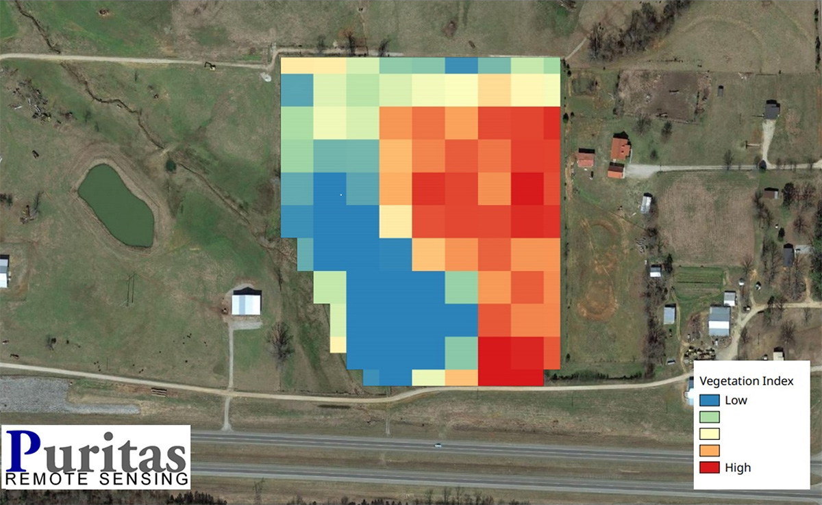
This farm in Courtland, AL needs immediate attention in its northwest and southwest areas. Each of the pixels (squares) measures 20m x 20m, or about 65’ x 65’. That enables the farmer to “surgically” treat more than ten specific areas on each acre of his land.
